
New online from the National Library of Scotland, the most detailed Ordnance Survey maps for post-Second World War England, Scotland, and Wales. No colour.
Houses are shown individually, often with the house number. Significant buildings, like churches, libraries and cinemas, are labelled. Bomb sites are labelled as Ruin(s).
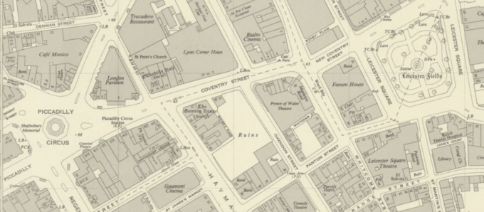
Full detail and access at https://maps.nls.uk/os/national-grid/
Learn how to find and make the most of the NLS’s maps in an online interactive workshop at 9 am on Wednesday, 26 June 2024.
https://www.nls.uk/whats-on/navigating-the-maps-website-june/
Very cool – just found a detailed map of where my mum and her siblings grew up!