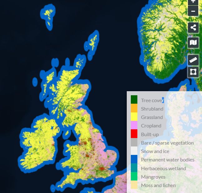
Having been raised there I shouldn’t have been as surprised as I was to see the dominance of Eastern England, especially East Anglia when it comes to cropland.
As the ESA WorldCover Viewer map provides data on land cover at 10 m resolution across the whole world you can get in close to a place of interest. The map distinguishes 11 different classes of land cover, including tree cover, grassland, cropland and built-up land.
via Maps Mania.


One thing of interest to me is how LITTLE of the UK’s land mass is suitable for farming. Scary. It shows how in WWII the UK was so dependant on imports for its food, hence convoys. Cheers, BT